EagleView’s Ultra High-Resolution Aerial Imagery Shows Hurricane Zeta Damage
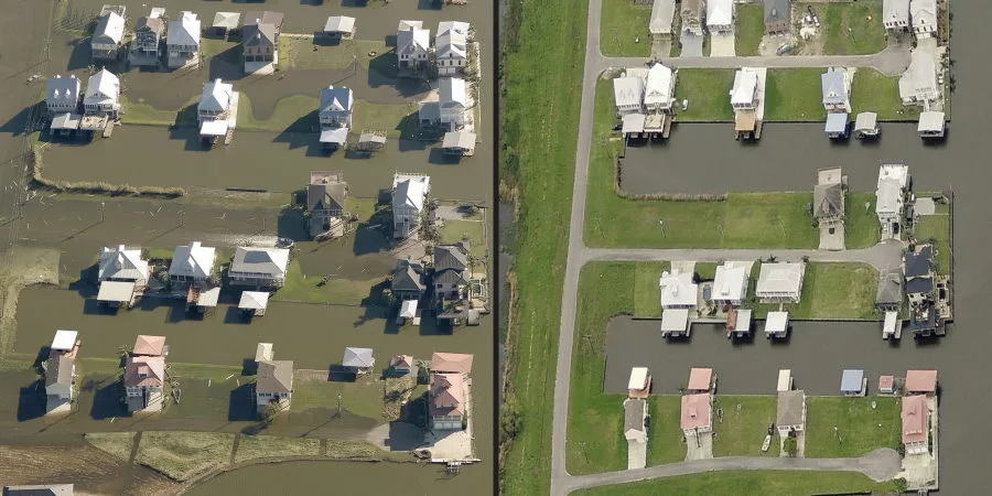
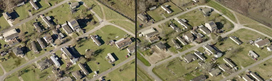
Before and after images of Louisiana properties following Hurricane Zeta. Image courtesy of EagleView.
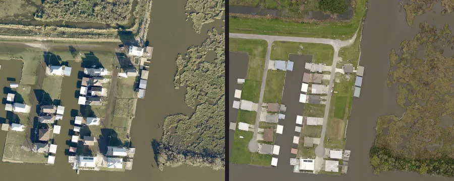
Before/After photo courtesy of EagleView Technologies.
BELLEVUE, Wash. — EagleView and GIS solutions for government, construction, and insurance has received its first post-event images following Hurricane Zeta. As soon as weather conditions permitted, EagleView’s fixed-wing aircraft were in the air capturing ultra-high-resolution Reveal™ aerial imagery at Property Level, which ranges between 0.8-3 inches ground sample distance (GSD) depending on environmental factors.
EagleView imagery is an essential tool for first responders, insurance carriers, and construction contractors. EagleView provides rapid access to post-event property information such as roof damage, flooding and fallen trees, without having to send people into potentially dangerous areas. Leading up to Hurricane Zeta’s landfall on Wednesday, Oct. 28, EagleView began staging multiple aircraft and planning areas of interest to ensure rapid image capture.
Customers can find EarlyAccess™ images on CONNECTExplorer, EagleView’s interactive viewing platform. While images continue to be processed in-house, seeing the initial impact of the damage from the sky early in the process is an invaluable resource for local governments, contractors, and insurance carriers.
EagleView's photos and services are among those that have helped roofing contractors who are struggling to keep up with the influx of work due to this year's above-average storm season. Hurricanes Laura, Sally and Delta previously struck the Gulf Coast, causing even more strains on supply chains already stressed due to the COVID-19 pandemic.
Looking for a reprint of this article?
From high-res PDFs to custom plaques, order your copy today!
.webp?height=740&t=1781278983&width=auto "KEE(2).png")


