Eagle View Technologies Staging for Aftermath of Hurricane Michael
BOTHELL, Wash. — Fresh off responding to Hurricane Florence, Eagle View Technologies is already developing plans to take aerial images of damage done by Hurricane Michael for its government, insurance and commercial clients.
As it did with Hurricane Florence, the company will use satellite, drone and fixed wing aircraft to document the damage from above, once granted access into the airspace by the Federal Aviation Administration. Among its offerings will be the company’s proprietary ultra-high-solution Reveal imagery.
With post-event imagery, insurance carriers can close claims rapidly despite high post-storm volumes, and local government agencies can quickly provide aid to those impacted — and contractors can get to work sooner.
As Roofing Contractor reported Oct. 9, Hurricane Michael could cause up to $13.4 billion in damage. Hurricanes Michael and Florence come about a year after Hurricanes Harvey, Irma and Maria caused an estimated $265 billion in damage in southeastern Texas and Florida.
“As a company, our first mission is to make certain we are responding to our customers’ needs as quickly as possible,” stated EagleView COO Jay Martin. “To do this, we strategically stage our aircraft so that we’re prepared to take flight immediately once granted airspace access in order to support our customers.”
Melissa Mazurek, spokesperson for EagleView, told Roofing Contractor that the company has “multiple aircraft currently mobilizing and already stages in the states surrounding the predicted impacted areas to capture post-event aerial imagery” and that additional aircraft also will be used.
“Flight planning is in progress by our disaster response team,” she said.
The response will be similar to what EagleView recently did in the Carolinas following Hurricane Florence.
With its pre-staged CAT response fleet, EagleView was able to access the airspace of the affected regions beginning with Dare County, N.C., the home of the first Wright brothers’ Kitty Hawk flight.
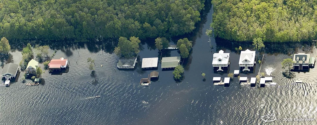
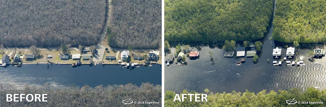
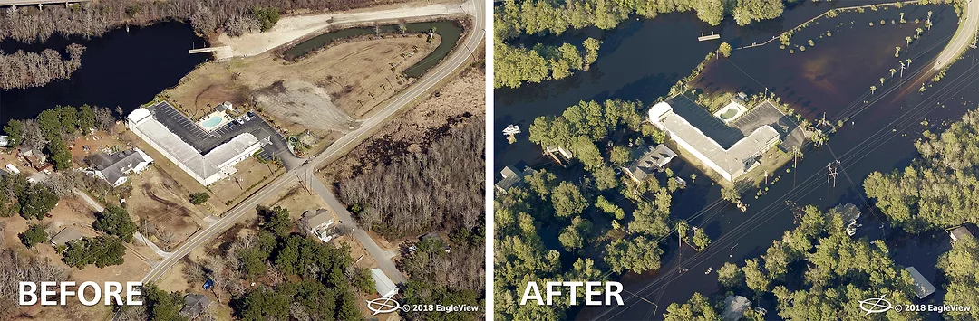
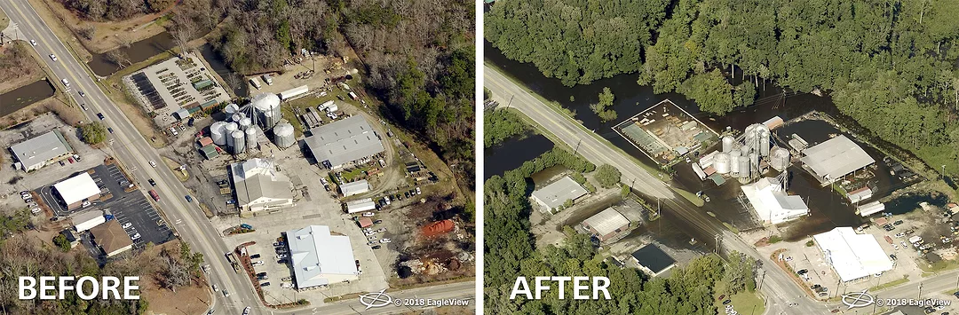
Customers of EagleView had access to pre- and post-storm imagery as quickly as 24 hours following capture on the imagery platform CONNECTExplorer, allowing for a complete understanding of the damage caused by the hurricane.
As the weather improved, EagleView captured the entire affected region with the CAT response fleet. By combining multiple imagery sources, plus recently captured prestorm imagery, customers had a comprehensive birds-eye view of the damage on the ground.
“Our ultra-high-resolution aerial imagery is one of the many tools used to help communities get back on track following a catastrophic event,” said Rishi Daga, EagleView CEO. “By flying and capturing post-event imagery as soon as we can, EagleView is able to provide the support needed by emergency management, claims adjusters and others to get the victims back into their homes sooner.”
Learn more about EagleView at www.eagleview.com.
Looking for a reprint of this article?
From high-res PDFs to custom plaques, order your copy today!
.webp?height=740&t=1781278983&width=auto "KEE(2).png")


